
Jeff noted that this robe was a gift when he was in high school.
We made it to SF without incident late last night. Jeff kindly picked us up at the BART station at midnight and fed us before turning in.
Jeff noted that this robe was a gift when he was in high school.
We made it to SF without incident late last night. Jeff kindly picked us up at the BART station at midnight and fed us before turning in.
Wakey, wakey….
Fun, fun…

For the third year in a row, some friends and I have headed out from the cobblestones at the Mississippi River in downtown Memphis and walked, more or less, in a single direction. After going east in 2007 and south in 2008, we headed north-ish this year, looking to take in the northern reaches of the city, such as Greenlaw, Frayser, Raleigh, and then the suburbs beyond, such as Bartlett and Lakeland.
One big difference about the walk this year had to do with the temperature. I’ve had an unusually busy past few months, and this was the first weekend where it was possible to find a weekend day to do the walk. Unfortunately, it is also December, which usually means cold, even in Memphis, so it was a bit more brisk than the other walks, which were done in October. At sunrise, when we set off, the temperature was still a few degrees below freezing.

Despite the cold, some of the trees are still turning colors, like this one in front of the city government building on Main Street. We left the cobblestones and headed up into the hill into downtown, taking a left on Main Street and following it until we could cut over to Chelsea.

Did I mention that it was cold? It is hard to see in this picture of Richie and Robert, but there actually is steam coming out of the sewer, which is relatively rare, even in the winter in Memphis.
Chelsea is one of the more interesting, and disadvantaged, streets in Memphis. Sights like this Ford Explorer with a missing window and back tire are common. One could wonder which one went first.

Abandoned infrastructure was abundant, like this abandoned railroad bridge near Chelsea at Watkins.

Walking up Watkins toward Overton Crossing, we stopped to check out the trollies that looked as if they had been used for parts for the current MATA downtown trollies. Interestingly, all of these were covered in Spanish. It wasn’t clear if they has previously been in service in Mexico, Spain, or somewhere else.

A lot of the route was long and straight, such as this stretch of Watkins as it crosses the Wolf River. We talked about having seen this bridge from our Urban Wolf trip several years ago.

The small community of Rugby in North Memphis provided some of the most interesting sights of the trip, such as this large brick post that marked the entrance to the area.

Rugby is pretty disadvantaged, as is the neighboring community of Frayser. We came across several houses (and apartment buildings) with the doors kicked in and who knows what going on inside of them. At least the number of random loose dogs running around was pretty low, though the cold may have helped with that. A number of properties in the area are in bad shape. I wonder how much this one goes for…

I can never pass up a chance to get a picture of myself next to an interesting topiary. This one is outside a pet grooming place on Frayser Blvd.

One unexpected thing was the abundance of wildlife. We got a photo of this deer in a field right off of Frayser Blvd, while it was down in a field, searching for food.

The town of Bartlett marked the edge of Memphis and brought with it long stretches of stretches of Yale Road, where there was nothing to see but suburban houses, churches, schools, and more churches.

As we prepared to turn off of Yale Road and head up Summer Avenue toward Appling Road, Robert and Richie took a short rest. We didn’t take much downtime during this walk, just a coffee break in Frayser and a BBQ meal in Bartlett. The rest of the time, we were on the move.

Dave was out riding his motorcycle nearby, so he joined us for a bite at Fat Larry’s BBQ in Bartlett. They serve a very good representation of Memphis bar-b-que, and while not the best I’ve ever had, I was famished, and it really hit the spot.

Being winter, the sun started going down pretty early, so we tried to make up time by crossing fields, with the hope of getting to Lakeland by dusk.

We crossed the Memory Hill cemetery at sunset, and I got this shot of the fountain and ducks in the last few minutes of sunlight.

After crossing through some woods, we were eventually turned back by the growing darkness and the desire not to be shot by the wacky cul-de-sac McMansion owners whose yards we were going to have to cut through. By the end, we had Lakeland in sight, but a fence and some horse standing the woods marked the last point of our advance, and fearing a trespassing charge, we headed back the road and out to Germantown Parkway, for a gracious pickup by Dave, who had gone home for his car.

The total mileage for the walk was 22 miles, which easily makes it our longest walk to date. We were all sore and stiff at the end, but I found myself contemplating the route of next year’s trip on the way home. There is simply so much left of the city to explore.
For Kath’s birthday, we decided to spend the weekend in Hot Springs, AR. After a few trips to the Arlington for baths, we are both feeling completely relaxed and looking forward to perfect fall evening and a scrumptious dinner.
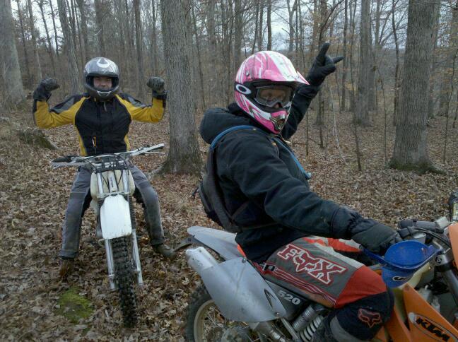
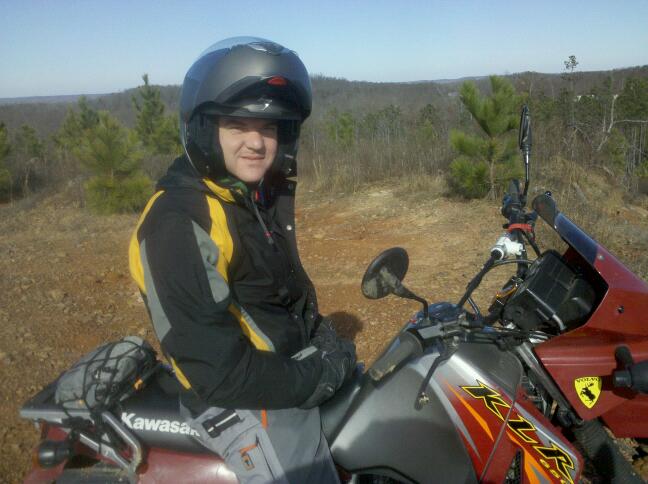
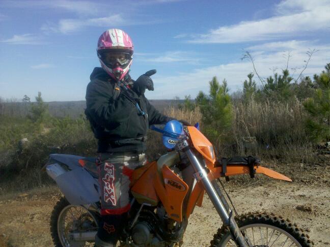
The big news this past week is that Dave bought a motorcycle, a 2006 Kawasaki KLR 650, the same model and year that I have. This is a very good thing, as we can bring one set of backup parts for long rides, and we will both be more likely to know how to fix problems with each other’s bikes. Here they are, with Wisch’s Suzuki DR 650, before we got them muddy on Sunday:

We rode for about 3 hours on Sunday in Crittenden County, just over the Mississippi River from Memphis. I wanted to show the guys something interesting I found a month or so ago, which is the exit point for the original automobile traffic bridge over the Mississippi for the area. It is located right next to I-55, on a old railroad bridge where they bolted steel girders onto the bridge and covered them with huge wooden planks almost the size of railroad crossties. You can’t see any wood in this shot (it has all rotted away), but you can see what remains of the bridge as it arches up and prepares to go east over the river and toward Memphis.

It was a beautiful day to go riding, needless to say. We ran into a really nice guy from Midtown out riding on the dirt roads with his girlfriend, and he took us to a nice spot opposite Memphis, evenly between the I-40 and I-55 bridges, almost even with the end of Mud Island. We all enjoyed the view of downtown, and while the river was rising, it almost looks so calm as to be swimable.
Here’s a shot of Wisch and the scene across the river, back toward Memphis.

Here’s Dave before I accidentally sprayed him with mud from my back tire as we were leaving that place. (Sorry about that Dave…)

We got deeper into the mud that afternoon, going all of the way from I-55 to a road north of Marion entirely on dirt (well, dirt, mud, deep puddles, and lots of fallen, wet leaves). The ride was challenging but rewarding, and we all got adequately lost and dirty. We ended up taking a rest in Marion before heading back over the I-40 bridge back to Memphis.

If only Big John’s had been open.
If you are looking to read about an incredible adventure motorcycle trip, please read their ADV Rider thread. Yes, I know it is over a hundred pages long, but the hours spent will be worth it. If you only have 10 minutes, just read a few pages, perhaps of their ride from this summer. In summary, some truly crazy (and very brave) guys traveled from Poland to Magadan in Eastern Siberia in 2007, and this year, they explored a big chunk of Eastern Siberia, usually without even the benefit of roads. They didn’t let the isolation of the area, or the bears, or the lack of fuel or spare parts, stand in their way. This looks to be an amazing adventure, and they are still publishing pics from the summer ride daily.

The next morning was, well there’s no other word for it, CHILLY. We built a roaring fire and tried to warm up enough for a last ride on the bikes before heading home. There were several trails near the campsite that we hadn’t explored, so we finally suited up and headed south on Johnson County Road 5861 from Highway 123, which was a beautiful ride right beside Big Piney Creek. Well, at least, until we came to the end of the road, which literally terminated by running directly into the creek. It wasn’t even clear if the road continued around the bend or not.

So, we turned around and headed back to Highway 123 and got some pics underneath the one-lane bridge we had stopped on the night before to look at the stars.

Still not ready to leave, we headed north on County Road 5861 (right beside the bridge), which turned out to be one of the best rides of the weekend. We quickly came to some higher ground with much better creek crossings than the road that ran south. David got soaked crossing the creek here, but it made for a fantastic picture.

Scottie’s lighter bike made crossing these creeks look easy. Or maybe he’s just better at it…Â 🙂

For several miles, the road just meanders beside Big Piney Creek, with high rock walls on one side, dripping waterfalls from time to time, and the full creek on the other side. It was gorgeous.

You could even ride underneath one of the waterfalls.

Eventually, we turned right and followed followed Forest Road 1202 up into the hills, which presented some beautiful views of Big Piney Creek as it slithered through the valley below.

The weather was warmer and sunnier than any of the previous days, and we all would have loved to have been able to ride the rest of the day, but real life beckoned us back, out of the wilderness, away from the falling leaves, and into the cruel arms of responsibility and schedules.
OK, going home wasn’t that bad, but we all had a wonderful time, and we were already making plans to come back as soon as possible, even if the leaves were already gone.
Found this thread via search engine? See all of the photos of the trip, or review Day 1 or Day 2.

Haw Creek Falls is a beautiful place to wake up in the fall, with leaves turning colors seemingly before your eyes and misting water cascading over rocks providing a gentle roar all night long. Several large creeks surround the campground, but there are only a few that line the side of the creek, so get there early in the day to claim those.
Sun began peeking through the clouds early in the morning, promising warmer temperatures, but most of the day remained colder than the day before. As we breached hilltops and could survey the entire sky, fast-moving dark clouds threatened rain but never carried through. Hoping for lunch in a diner, we headed west toward Oark, down little forest roads that looked like this.

I was glad to have left the liner in my jacket that morning. It was still pretty cool when we stopped to take this picture.

Forest road 1003 snakes along Mulberry Creek from Highway 21, providing a gorgeous trail through falling leaves and great views down toward the rushing water. I started to not even notice the cold, and before I knew it, we were emerging onto blacktop just outside of Catalpa, almost to Oark on Highway 215.

The Oark Cafe is a interesting place, certainly one with a vibe it has maintained for over 100 years. For camper vans and sports cars (or anything else that doesn’t really want to get its tires dusty), it has an end-of-the-world feel about it. If you were drive by it heading east, the asphalt would soon give out and you would begin wondering if you should have purchased gas when you had the chance. More than a commercial oasis surrounded by beautiful farms and hills rising to wilderness, the Oark Cafe retains the charm of a one-room restaurant and grocery from years past, complete with some of the friendliest proprietors I’ve ever met.

After having lunch at the Oark Cafe (you have to try the hamburger with onion rings when you visit), we headed north and left the pavement behind again, heading into some hidden valleys, taking every chance we got to turn upon a smaller and smaller road. You can find some funny little private bridges in these parts, too.

Little streams trickle through the forest all over this area, especially after the weeks of on-again-off-again rain that we’ve had this year. Sometimes, you weren’t sure if you should keep the dual-sport motorcycle on the road or turn off and follow one of these streams to see where it came out.

There isn’t an abundance of signage in this area, but I was grateful for the foresight of the last major stimulus package to be spent in the area, during the 1930s and 40s, when the national forest roads were built. I think it would be hard to argue they weren’t a good investment, considering that the many county and farm roads that run off of them provide almost all of the vehicle access to this rather large area.

As the day continued, we took smaller and smaller trails, many times ending up in at someone’s backwoods cabin with no way to continue or emerging in a clearing with a cluster of camo-wearing bow hunters all clutching their beers. Everyone was friendly, though, and helped give advice to get us back to a bigger trail. I picked up a few off-road symbols that provided some lessons:
1) Never go down a road with a mailbox at the end of it, unless you want to turn around and come back out the same way. The mailbox is there because the mail person can’t make it down that road and come out somewhere else.
2) If you start seeing trucks with trailers attached behind them parked along a trail, it is about to get rougher.
3) If you start seeing trucks with no trailers parked beside the trail, it is about start getting really rough and the trail will narrow.
4) The Gazetteer will be wrong about the name of a forest trail or where it comes out about half the time. Deal with it.
5) You can’t trust any signs in the woods, so if you get lost, find a person to ask rather than relying on signage.
A lot of the roads that afternoon looked like this.

We ended up coming out of the woods near Deer, a small town 10 miles or so north of our campsite but more than 25 miles away by pavement. We were looking for a place to buy steaks to take back and cook at the camp, but the only thing open was a diner, so with the light fading fast, we enjoyed some catfish and warmed ourselves next to a small gas fireplace, listening to a recap of the tragic Arkansas-Florida football game earlier that day (#1 Florida won by a field goal after scrappy Arkansas missed 2 field goals and the officials blew 2 big calls that went against Arkansas and probably cost them the game).
Leaving the diner in Deer in nearly complete darkness, there was some debate about whether to head back via a more direct route over forest trails or take the sure-thing route via the paved roads. After not being able to find the trail head in the dark, we elected to take the more paved roads. By this time, the temperature was down to about 40, and the wind was icy while at speed. We finally made it back to camp, after pausing on the little one-lane bridge near Haw Creek Falls to take in the canvas of stars in near-total darkness.
Later, as we took the same forest trails the next day that we would have taken back that night, we realized that we would have never been able to find our way back on those trails and would have likely spent the night out in the woods, if we had found the trail head.
Continue reading this thread with Day 3 here.
Just joining us? Check out Day 1 here or review all of the photos from the trip.

I knew when we turned on to Highway 123 off of 7 that the riding was going to be amazing. Having never spent much time in the southern Ozark Mountains, about 80 miles east-northeast of Little Rock, I didn’t really know what to expect. Surely there would be trees, some hilltop views, and some twisty road riding, but it was a mystery just what else we would find.
Boy, was I in for a treat…

We selected to camp in the Haw Creek Falls campground upon setting out from Scottie’s place. This beautiful spot, just off of Highway 123, doesn’t provide drinking water, but the camp sites are few, clean, and located right next to the falls and a lovely rushing stream, meaning we fell asleep to the sound of rushing water and woke up to a misting waterfall with autumn red and yellow colors in the background on the surrounding hills. Haw Creek Falls offers some wonderful hiking and is a great location to use as a base for float trips in the area (click here for a pretty good free map), but all we could think about when we arrived was getting the bikes off and hitting the trail.

We immediately headed down 123 and found a forest service road (1003) off to the right that took us northeast, into the Ozark National Forest. There are county roads, farm roads, and forest service roads throughout this area, as well as ATV trails, some of which connect to one another and others that just simply end up at some wide spot in the woods. We went down both extensively over all three days, sometimes poking out on a major highway, and other times running into a dead-end at someone’s hunting cabin and needing to turn around.

Everywhere we went, there were little streams to cross, ledges to peer over, and straightaways to zoom down. Occasionally, we would run into someone on an ATV, usually carrying a bow (it was bow hunting season), who would occasionally stop for a chat. But, most of the time, we saw no one. It felt like having this section of the Earth to yourself, where some giant painter had dripped color that changed shades as the sun skimmed across the horizon.

The best ride of the day was an accident. Click on this link to see a satellite photo of the area. We crossed this little bridge over Big Piney Creek, and Scottie decided to take a little road up the hill to the left, which is marked on the map as City Road 311 (but the last way I would describe this is as a “city road”). This little windy road took us up above the creek for miles, up and down the little hillsides in the area, but always keeping the rushing creek, thanks to all the recent rain, just to our left. It felt like finding a tiny little gem that no one else knew about. We saw no other human beings or activity for an hour, just falling leaves, a well-maintained dirt road, and the sounds of water rushing over rocks. Perfect.

We only rode for three hours the first day, but it was just enough, and we returned to camp to feast on some chili pie and homemade brownies. It got a little cooler that we would have liked, but we had a big fire, plenty of beer, and even a nip of scotch. And a full day of riding awaited us the next day.

Read on to Day 2 of the ride, or check out all of the photos from the trip here.

I just got home from a fantastic motorcycle ride this weekend through the Ozark National Forest.
Scottie, David, and I made the most of our time, riding Friday afternoon, all day on Saturday, and then a good part of Sunday.
We climbed up and down rocky ravines, zoomed down gravel forest roads with yellow and red leaves falling around us, and went places that the confused both our Gazetteer and the GPS.
I’ll post some more text on this trip, when I get a few free moments, but you can already see some of the pictures here.
We were sure Rome was going to be a pain. Almost every large city we’ve ever visited while traveling seems to pull more out of you than it puts back. Our goal was to just to try to have a decent time in Rome during the 2 days we had there and try to see some highlights at the end of our trip, before heading back to the States. Our stay in Rome turned out to be a lot more enjoyable than we imagined, and a lot of that was due to the centrality and comfort provided by the place we stayed: Hotel Assisi [Google map].
After all, when you imagine being in Rome, you might imagine hanging out at the Colosseum.

However, finding a place to stay near the Colosseum, one that is also comfortable and safe and offers good links to travel beyond the city, well, you have options, but it can be difficult to figure out which one to choose. We went with Hotel Assisi, which received several good reviews online and is a relative bargain at 80€ per night for a double. Is is also located only a couple of blocks from the central train station in Rome, Termini, and easy access to the metro.
On the downside, I saw this random scene from the remains of a very localized Vespa fire a block away from Hotel Assisi and Termini, so it isn’t clear how safe your vehicle would be if you parked it in the area.

The lobby of Hotel Assisi is where you enjoy the excellent complementary breakfast (feature all of the espresso you can drink!) and a good (if charged per hour) wifi connection. There is also lounge area with some entertaining ancient tourism videotapes of Rome from the 1970s. Don’t miss those!

Our only complaint is that our room’s fan made a lot of noise (which the management fixed after we told them about it) and the air conditioner in the room didn’t really work to cool it (and there was no way to turn it up or change the settings – which left the room pretty hot). However, the neighborhood around Hotel Assisi is pretty quiet, so we slept well with the windows open.
The bathroom was pretty small but very clean and adequate. There are two competing and excellent Italian restaurants just outside the front door of Hotel Assisi, so getting a good meal at a decent price, even late, is pretty easy. The reception was cordial and helpful, offering advice about the best sites to see (and order to see them in, based on our time limits), as well as providing options concerning getting to the airport (which is pretty easy from the train station – there is a special train that runs every half-hour that takes you there).
All in all, Hotel Assisi was a good deal for the money. You could do a lot worse.
Contact Information:
Hotel Assisi
http://www.hotelassisiroma.it
info@hotelassisiroma.it
Via dei Mille, 29
00185 Roma, Italy
(39) 06 445 3813
We were unprepared for the Garfagnana region. We thought we were just heading into a more hilly region of northern Tuscany. Little did we know that we were actually heading into some real mountains. Accessible mountains, but mountains all the same. The small community of Piazza al Serchio provides an excellent stepping stone to explore this region, and the tiny nearby hamlet of Petrognano [Google map] contains a nice place to stay while you do it: La Chica, a quaint bed and breakfast.
Unfortunately, we spent too much time taking pictures of the beautiful nature of the area that we never thought to get a picture of our room or the outside of the building. However, the central location of La Chica is one of its best attributes, as it helps to get you keep into the nature of northern Tuscany that is impossible to do if you stay somewhere like Lucca or Pisa or Florence. And vistas like this are just stunning, as you are driving up and around the mountains of the region.

The towns are charming, too. This is Castelnuovo di Garfagnana, a few kilometers down the road from La Chica, where two come together and make their way through the mountains to Lucca. The multicolored buildings were a treat in this place.

You are also near the Ponte del Diavolo (Devils Bridge), a medieval bridge that spans the river.

In between the larger mountains, there are serene and idyllic valleys, like this one below Castiglione di Garfagnana.

Where there are mountains, there are often lakes, and the Garfagnana region is no different. The Lago di Vagli features great picnic spots, a free swimming pool, and a little town in the center of the lake, surrounded by water.

Perhaps the best thing is that you will see very few tourists at all in the whole region, especially non-Italian tourists. There just simply aren’t any large buses showing up and disgorging tourists by the hundreds, as you see in Siena or the small towns in the south. You get a real sense of what I came to see as “real Italy” in the Garfagnana region.
The amenities at La Chica are adequate. The owner, Paola Pignatelli, lives nearby and really goes out of her way to help in any way she can. Note that English is more rarely spoken in Garfagnana, so be sure you have a good Italian-English dictionary if you have any special needs.
The room we stayed in was comfortable and larger than the others in the trip, and the bathroom was spacious and clean. Strangely, we never got any breakfast at this bed and breakfast, but this was probably our fault and we didn’t mind anyway. We stayed for 3 nights, and for 50€ per night, it was a pretty good deal. Again, you won’t be spending much time in your room here. The nature that surrounds you will call you to explore. And you won’t be able to resist!
Contact Information:
Bed and Breakfast La Chica
http://www.bbplanet.com/bed-and-breakfast-la-chica-garfagnana-piazza-al-serchio_s11386/en/
beblachica@libero.it
via statale, 9 Petrognano, Italy, 55035
(39) 328 705 9270
Hey, what is this? A post that has nothing to do with Italy? Crazy! Yes, I know, but I did something pretty fun today that had nothing to do with Italy, so I thought I would write about it.
After dealing with a bad cold the past couple of days and being notified that my Advanced Motorcycle Safety Class was canceled today (not enough people signed up), I headed north with Wisch to clear my head. We ended up exploring a large swath of western Tipton County, the county north of Shelby County, where Memphis is located. (Here is a map of the area where we spent most of our time.)
Some of the best roads were around Herring Hill Road (which is partially gravel), Pryor Road, and Coon Valley Road (which is almost entirely gravel). This picture may be the first one of me with my 2006 Kawasaki KLR 650, which I’ve had since May.

Wisch took this while we were on the Richardson Landing boat ramp, which currently ends in a very low Mississippi River. This is a shot of Wisch on his Suzuki DR650.

Note the clearly superior riding gear. I’ve really got to get a light, bright jacket with armor sewn into the joints. What isn’t clear in this photo is Wisch’s equally clearly superior riding skill, but someday I’ll get a movie of one of his trademark wheelies and prove it to the world. His skill on the superbike track is already pretty well known.
Perhaps one of the most strangely beautiful sights I’ve seen recently is how this little road twists and turns through an area completely overgrown with kudzu. Yes, everything except the trees, the sky, and the road in this photo is kudzu.

All in all, a very fun ride, one with several other small roads that we left to explore another day.
This place was a highlight of the trip. Located only a few kilometers from Montepulciano, in southern Tuscany [Google map], Casale a Poggiano fulfills the dream of what most people imagine about a vacation in Tuscany. Nestled on a hill and surrounded by tall trees and vineyards, the pleasures of the Tuscan lifestyle are spread before you, from the quaint ancient house to the friends you meet at breakfast.

Run by a wonderful woman named Isolina, Casale a Poggiano offers a great place to just take in the Tuscan atmosphere or as a launching pad to the many sites and towns just over the next set of hills, including Sienna, Pienza, Montalcino, Arezzo, Perugia, and Orvieto. This is the little town of Montefollonico, I think, as viewed from the backyard of Casale a Poggiano.

And this is the view of Montepulciano, which is only a 10-minute drive away.

Speaking of the backyard, the grounds are kept very clean and neat. (Just remember to dodge the monster pine cones that can fall at just the right time and crack you on the head. Seriously, they are dangerious…)

Everything about the place gives you the sense that it has been here for a very long time. Check out the lichen on the tile of the back house.

The back of the main house is covered with vines and windows that swing wide. You will swear that you have stumbled on the set of Under the Tuscan Sun.

There are little odds and end everywhere on the grounds, including this cool little flower planter made from an old plow, sunk into the dirt.

But, I’m sure you didn’t find this review to read about flower boxes… The four rooms available at Casale a Poggiano fit into the country lifestyle of the house. There are lots of classic, old touches, like the wash basin and the large armoire, create the sense that you are far away from modern life when you visit. There is even complementary local brandy and biscotti outside of your room, which you can enjoy with the complementary wi-fi, which tends to break the spell of being in the Tuscan countryside, but at least you can upload some pics from your trip thus far and catch up on some email.

Our visit was well timed, as Casale a Poggiano is usually pretty booked, particularly in July, but with the economic downturn of 2009, we were the only people there for 3 of the 4 nights we stayed. This really helped with the illusion that we were Tuscan nobles enjoying the fine weather in our country house, with our own private (and excellent!) pastry chef Isolina to whip up some unforgettable breakfasts.
The three upstairs bedrooms are located up the staircase in this picture. I hope the dog is still alive when you visit, as it is really old but a real sweetheart.

In short, Casale a Poggiano is a great place to stay, if you have your own wheels and don’t mind the 80€ per night high-season rate. (There are lower rates for other seasons and, possibly, other rooms. Ask when you call or email to book.)
Contact Information:
Casale a Poggiano
http://www.poggiano.com/en/
http://www.tuscany.net/poggiano/
via di Poggiano 21, Montepulciano, Siena, Italy 53045
(39) 057 871 6446 or (39) 328 732 2057
I’ve had several people ask follow-up questions about some of the accommodation reviews I wrote for some of our other trips, so I know that the reviews are getting indexed and people are finding them in search engines. We stayed in some pretty fantastic places in Italy (all booked expertly by Kath, I should add), so I thought I would continue the accommodation review tradition by looking back at the four places we stayed in the country. Spoiler alert: To one degree or another, we liked all of the places we stayed and would recommend them. However, read on, because the details for any particular place may cause it to be inappropriate for your visit.
The first place we stayed in Italy is Pensione Colomba, which is located in Praiano, a small town on the Amalfi Coast, south of Naples [Google map]. Praiano is a great place to stay, if you value getting away from the bustle of the larger towns in the region, like Positano, when you are ready to bed down for the night. Also, as Praiano is very vertical, heading straight up the hill from the sea, almost any place you stay will have great views. Pensione Colomba is located half-way up the hill from the main road running along the Amalfi Coast, the SS163, and it is such a hike to get up to the place that they utilize a cable lift system for your bags to take them up and down from the car park, which is next to the main road.

The stairs can be kind of brutal, especially if you have to make the trip several times a day. Thankfully, there are several ways to and from the main road from Pensione Colomba, so once you know Praiano, you will know what part of town you want to come out at and can take the appropriate set of stairs.

Enough about the stairs – let’s focus on the view. Even when you are climbing those stairs, you can always stop and take in the view, which make the climb a whole lot more enjoyable. All of the rooms in Pensione Colomba seem to face the sea. Our room was at the top of the building, which appeared to be somewhat built into the hillside. We shared a large balcony with another room, and when the sun set, we were treated to views like this.

Simply stunning. The air was still and clear for our entire stay, and it made the fantastic vistas available from Pensione Colomba even better. This is a view from the balcony across the sea and down the Amalfi Coast to the west. You could see for miles and miles.

Unfortunately, I didn’t get any pics of the room or the outside of the hotel. However, we found it very clean and more than ample for our needs. Like many hotels in Italy, Pensione Colomba features a complementary basic breakfast, served outside and facing the sea. Our room had a small bathroom but a decently-sized bed, writing desk, some chairs and such, basically a nice place to stay.
The staff really took care of us, even keeping some medicine we needed kept cold in their fridge. (The rooms don’t have refrigerators, which wasn’t a big deal.) Breakfasts were ample, and they will cook dinner for you or provide a bigger breakfast for a fee.
The key to the place, though, is the location and the view. Pensione Colomba helps you get up and away from it all, even on the busy Amalfi Coast, putting you in close proximity for day trips to Positano or Capri or Amalfi or some of the decent (but tiny) local beaches. We paid 70€ per night, which is a pretty good rate for the area, and we stayed 4 nights.
Contact Information:
Pensione Colomba
http://www.pensionecolomba.it
(089) 874079
info@pensionecolomba.it
Near the Vatican is impressive Castel Sant’ Angelo, which has been a castle, fortress, and prison for various popes over the years. The Ponte Sant’ Angelo in front of the castle is a beautiful bridge, full of very statues in dramatic poses.

We stumbled across the city, bouncing from gelateria to shoe store, eventually ending up at the Pantheon, which is one of the most impressive structures I’ve ever been in. Most impressive is the concrete dome, poured in place with scaffolding, which is one of the first uses of concrete and definitely one of the earliest examples of concrete that still exists and is useful today, more than 1900 years after it was built.
Even Kath was impressed…

After seeing the sights in the Pantheon, I went outside to rest and soon heard a commotion nearby. Thinking that someone may have been hit by a car, Kath and I joined the crowd streaming that direction. Instead of a traffic accident, we got a picture of Prime Minister Berlusconi emerging from a gelateria with a big cone full of the good stuff, looking very happy and flanked by a dozen security guards that melted into their vehicles when it was time to speed away.

To make sure that we come back to Rome, we had to make a final stop at the tourist mecca, the Trevi Fountain. Kath drew the short straw and got picked to throw the coin over her shoulder in the fountain, which is a tradition that is supposed to bring you back to Rome at some point in the future. It was quick and painless, and we got out of there.

Rome was much more than I was expecting, and the trip, as a whole, was even more enjoyable than I could have hoped for. We had a blast, and I hope to return to Italy someday and explore another set of niches of the country, such as Sicily, Lake Como, Cinque Terre, or Milan.
Where the Vatican gets you, so far as money is concerned, is the Sistine Chapel. I would estimate that the Sistine Chapel is, easily, the thing most people want to see in Vatican City, as it has images that some of the most beautiful and recognizable among any in Rome. I mean, that ceiling is something else, and the folks that run Catholicism aren’t stupid. They know a revenue opportunity when they see one.
So, what did they do? Well, even though the Sistine Chapel and St. Peter’s Basilica are right beside one another, they’ve set up a system where you have to enter the Vatican Museum to see the Sistine Chapel, and it costs 14 euro per person to enter the Vatican Museum. Also, because you are so far from the Sistine Chapel once you enter the Vatican Museum, you have to walk half-way across Vatican City, twice, to get back and forth from the Sistine Chapel.

What’s the good news? Well, for one, it’s worth it. Also, while you are trapped in the Vatican museum, the other exhibits are pretty good and worth seeing, and the cafeteria isn’t a rip off. All in all, it is still a must-do when you are in the area, but just try to put all the pointless walking out of your mind. At least you are walking down beautiful (but extremely long) corridors that look like this:

Once you get to the Sistine Chapel, the hallway narrows and you have to kinda squeeze through a little door to make it inside. Once there, you aren’t supposed to (1) say anything or (2) take pictures. However, everyone there (and it is usually standing room only) is doing both of those things, just about has loud and fast as they can.
The tourist-factor aside, the ceiling and walls (and just general architecture of the place) are amazing.

We visited in 2009, a few years beyond a reconditioning of Michelangelo’s masterpiece, and the colors were so vibrant, so alive, the painting really spoke to you, even with the tourist throng all around and the ushers coming in ever few minutes and yelling, “Silencio!”

The paintings extend down to the walls from the ceiling, with some characters in one painting bleeding over into another scene. The optical illusions must have taken years to perfect.

Outside, we found one of those wonderful, free, clean water spigots that are located all over Rome. While most folks just filled up their water bottles, I drank the cool water straight from the source. Yum!

We went to several very good exhibits and ate lunch there, and finally, we were ready to move on and see some more of Rome. The stairs as you leave the Vatican Museum were a final treat though. Quite trippy going down…

I really enjoyed the figurines on the stairwell railing.

Next up, we headed back into Rome and across the city.
We only had one full day in Rome, and we were determined to make the most of it. One place that seemed like it would provide a lot of bang for the buck is the Vatican, so we took the metro from the train station and zoomed under the city to the doorstep of the Vatican Museum.
As you are probably aware, the Vatican is a city within a city. Rome completely surrounds it, and while there is no document check to move from Rome to the Vatican, you can certainly feel the difference. Many buildings in the Vatican are visible from Rome. This is the view of St. Peter’s Basilica from the Ponte Sant’ Angelo.

Once you enter St. Peter’s Square, the immensity of the place really hits you. So much of Rome is made up of tiny little streets that crash into each other in seemingly random ways. It can be like a jungle, where you can’t see any landmarks and you aren’t sure which way is north or, even, which way you came from, if you turn around.
This is not a problem in St. Peter’s Square. The obelisk and fountain, plus the statues that surround the place, will help to remind you exactly where you are. And, if you get lost, some helpful (and colorful) Vatican guards will gladly show you the way.

The front of St. Peter’s Basilica also gives a little foreshadowing of how big it will be in side. Those little specks at the bottom of this picture are people trying to get in the main entrance.

Inside, you’ll find a lot of interesting stuff, including a dead pope.

Katherine got to touch the foot of St. Peter’s statue (a traditional Catholic ritual), while I gazed away at the amazing dome above it all.

When I turned off the flash and cranked up the exposure, I got a nice shot of light coming in the center of the dome.

St. Peter’s Basilica is free to visit, but be aware that there is a very strict dress code. No shorts are allowed, or dresses higher than the knee, or any shirt that exposes the shoulders or is too revealing. We saw several folks pointlessly arguing with the Vatican guards, seeking entrance when they were wearing totally appropriate clothes for a 41 degree Celsius day in Rome that didn’t meet the Vatican standards. Some of these folks were pretty angry, so be sure to dress appropriately, if you don’t want to make a quick trip back to the hotel to change.
After dropping off the rental car, taking a shuttle in from the airport, and getting settled in our hotel (Hotel Assisi, near the train station), we headed out to explore the city. Our first stop was to pick up my brother’s leaf. For the last few times we’ve gone abroad, my brother will get on Google Earth and pick out a tree somewhere near a place were we are going to be visiting. In the course of the trip, we track down the tree, get a leaf to take home to him, and take a photo. This trip’s tree was in the Parco del Colle Oppio, just to the northeast of the Colosseum. And, man, it was hot. And dry. But we got the leaf.

The Colosseum and the nearby Arco di Costantino don’t really look real up close. In fact, a lot of things really don’t look real in Rome, but you have to learn to just trust your eyes and enjoy what you can, trying your best to ignore the crush of tourists, and hawkers that follow tourists, and guys dressed as Roman soldiers that want you to take a picture with them, and tour guides that chide you in your native language if you don’t use their services.
Perhaps the most interesting physical thing about the Colosseum is the sheer number of holes in its ancient structural walls. Near every intersection of the marble blocks in the travertine pillars facing out has a huge hole in it, some so large that you can’t understand how the entire structure can stay up. Apparently, I’m not the only one that noticed this. The odd thing about these holes is that they formed so long ago that no one is exactly sure what caused them. The leading theory is that iron clamps were in place to hold the blocks together but were taken out in the 5th century to be used for other things, during a period the Colosseum was starting to be used as an unofficial building material warehouse.

Another of the most interesting remains we came across is the Porticus Octaviae, which has a fascinating history and allows the visitor to see several different styles of ancient architecture, materials, and architectural purpose in the same building, while standing the exact same spot. There is something that stirs within you imaging this place as a library, curia, and fish market through the years, this now ramshackle, almost dangerous-looking ruin located a dozen or more feet below the current level of the street. You can see the ancient (and largely destructive) attempts at patching it, to keep it a viable building for daily use.

Nearby the Porticus Octaviae is the Temple of Apollo, or what stunningly remains of it.

Rome wasn’t all old carved marble to us, though. We wanted to experience some of the street life, and we found some of the best local flavor and least tourists, in the old part of town at least, in the Trastevere area. I mean, who could not love a place that could make a meringue cookie this large?

The Pantheon was a treat, as well, but we wanted to spend more time than we had left in the day, so we bookmarked the spot in our mind and agreed to come back tomorrow.

While walking back to our hotel, we practically stumbled by the famous Trevi Fountain, which only has its majesty diminished due the crushing crowds that jostle for position near the edge of the water and along the steps beside. The scene on the fountain confused me, but I’ve since learned that is depiction of virgins leading Roman citizens to the source of pure water outside of Rome that ends up in the fountain. Ironically, the carvings of natural rocks, which are actually carved out of natural rock (marble), make the fountain so striking, in addition to it’s sheer size.

Once the blasting heat of the sun starts to fade, Rome really starts to turn on the charm. Street life has this kind of intimacy in Rome, one where you can’t help bumping into strangers as you scan your surroundings for the ever-present little nuggets of art, tiny treasures that Romans have come to expect and internalize and take for granted.

I had come expected a gritty city, but Rome had begun to charm me, despite the heat of mid-July.
We were due back in Rome in a few days after returning from Grado, and other than the roads, we hadn’t seen much of the Garfagnana region. The next morning, we headed down the main road of the region, along the river, heading south toward Lucca. Along the way, we came across this cool old medieval bridge, the Ponte della Maddelena (or sometimes called the Ponte del Diavolo – the Devil’s Bridge).

It was very steep in the middle and more than 900 years old, but as amazing as that is, I found it more strange that the hundreds of motorcycles moving on the roads on either side of the river didn’t want to cruise up and over the bridge. After all, there were no stairs to block them. I guess the few tourists taking pictures at the top of the bridge really put them off of that idea.
We wandered through several of the larger and smaller towns of the region, including Castiglione di Garfagnana, where Katherine took a quick rest in a very beautiful spot.

One of the wonderful things about the Garfagnana region is that you can really get far, far away from the major roads and enjoy nature with Italians doing the same thing. During one of our loops off of the main road, we drove beside the Lago di Vagli, which features a picturesque town toward the middle of the lake, which was formed by a dam and has an abandoned village at the bottom of it that you can actually visit every few years, when they drain the lake.

All along the way, I made sure to keep myself caffinated. But all of those uppers required some downers for, well, you know, equilibrium, so you have to balance it out with a beer or a glass of wine. The risk, though, of course, is that you can look like this at the end of the day.

Rather than zooming directly back to Rome via the autostradas, we headed west over the mountains and were able to see many of the famous mountains that contain some of the world’s finest marble. And the scenery wasn’t half-bad either…

We emerged from the mountains near the sea and headed south to a very crowded Pisa. The leaning tower was the major draw, as you might expect, but the tourists were almost a sight to see by themselves, disgourging from buses and bumbling through ramshackle street shops, wandering into the light and expressing their wonder at the sights in front of them by acting like they were holding up the tower for hundreds of photos taken per minute. I mean, there was literally a line of people waiting to get the correct perspective to make the same optical illusion joke as the person directly in front of them.
Oh well, the duomo and the tower are very beautiful and worth experiencing close up.

And that lean is very real. I really didn’t expect to really worry about the structural integrity of the tower, but even with the actions they’ve recently taken to preserve the tower – like taking out the marble columns on the downward side and replacing them with lighter materials – I’m not sure I would want to go up there. And the waiting line of tourists and high admission price settled it.

Before the Romans dominated the peninsula, Etruscans ruled the roost. We swung into the Tuscan southern highlands and explored a few ancient towns founded by Etruscans among an area of hot springs. We also explored a small island connected to the mainland by a small spit of sand and a bridge. Porto Ercole really looked like an interesting place, but we were running out of light.
We didn’t actually make it Rome that night, but we did find a decent pension 30k north of Rome, along the sea.